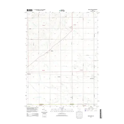
2013 Map of Mark Center
USGS Topo · Published 2013About this map
Mark Center and the surrounding agricultural landscape of northwest Ohio appear here in the early 21st century. The map details a transition between rural townships, characterized by a grid of farm-to-market roads like Wonderly Rd and Farmer Mark Rd. The local drainage network is central to the area's geography, featuring the branching headwaters of Gordon Cr, including the N Fork Gordon Cr, Middle Fork Gordon Cr, and S Fork Gordon Cr. Small settlements and historic junctions serve as focal points for local history, notably Six Corners and Rosedale. Family legacy and community history are preserved through several scattered burial grounds, such as Spindler Cem, Six Corners Cem, and Lost Creek Cem. The intersection of agriculture and modern infrastructure is visible through features like Visser Dairy and the small Arend Airport near the southern boundary.
Find a feature on this map
46 named features on this map. Tap any name to fly to it.
Don’t see what you’re looking for? This feature index may not catch every label — zoom into the map to look around manually.
Map Details
Editions of this 2013 Mark Center Map
This is the sole edition of this map. No revisions or reprints were ever made.
Other maps of this area

1914 · Bryan
USGS Topo · 1:62,500

1914 · Paulding
USGS Topo · 1:62,500

1943 · Bryan
USGS Topo · 1:62,500

1944 · Paulding
USGS Topo · 1:62,500

1953 · Fort Wayne
USGS Topo · 1:250,000

1956 · Fort Wayne
USGS Topo · 1:250,000

1958 · Hicksville
USGS Topo · 1:24,000

1958 · Woodburn North
USGS Topo · 1:24,000

1958 · Butler East
USGS Topo · 1:24,000

1960 · Sherwood
USGS Topo · 1:24,000