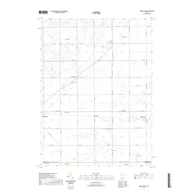
2019 Map of Mark Center
USGS Topo · Published 2019About this map
Mark Center and the surrounding agricultural landscape of Defiance County are defined by a dense grid of township and county roads that follow the original Public Land Survey System sections. Small rural settlements like Six Corners, Rosedale, and the eastern edge of Hicksville serve as anchor points across this northwestern Ohio terrain. The area is heavily intersected by the drainage networks of the N Fork Gordon Cr and its various branches, alongside Platter Cr and Lost Creek, which meander through the flat fields. Local heritage is preserved in several small burial grounds, including Lost Creek Cem, Six Corners Cem, Spindler Cem, and Kent Cem, which often represent the earliest established community centers in the township. To the south, Arend Airport stands as a notable modern landmark amidst the traditional farmsteads and creeks that have long dictated the region's development.
Find a feature on this map
62 named features on this map. Tap any name to fly to it.
Don’t see what you’re looking for? This feature index may not catch every label — zoom into the map to look around manually.
Map Details
Editions of this 2019 Mark Center Map
This is the sole edition of this map. No revisions or reprints were ever made.
Other maps of this area

1914 · Bryan
USGS Topo · 1:62,500

1914 · Paulding
USGS Topo · 1:62,500

1943 · Bryan
USGS Topo · 1:62,500

1944 · Paulding
USGS Topo · 1:62,500

1953 · Fort Wayne
USGS Topo · 1:250,000

1956 · Fort Wayne
USGS Topo · 1:250,000

1958 · Hicksville
USGS Topo · 1:24,000

1958 · Woodburn North
USGS Topo · 1:24,000

1958 · Butler East
USGS Topo · 1:24,000

1960 · Sherwood
USGS Topo · 1:24,000