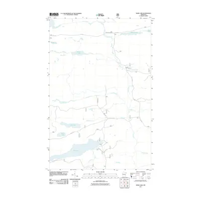
2011 Map of Mark Lake
USGS Topo · Published 2011About this map
Cascade River and its numerous tributaries, including McDonald Creek and Thompson Creek, define the drainage patterns of this forested interior of Cook County. The map captures a landscape dedicated to recreation and timber access at the start of the 21st century, centered on the Cascade River Campground and the Eagle Mountain Trail Parking area. A complex network of forest roads and historic corridors like The Grade provides access to a series of glacial water bodies, from the expansive Pike Lake and Mark Lake to the smaller Babble Lake and Swamp Lake. This 2011 survey documents the road network on U.S. Forest Service lands, including Cascade River Rd and Murmur Creek Rd, serving as a modern record for those studying the evolving land use and access points within the Superior National Forest region.
Find a feature on this map
26 named features on this map. Tap any name to fly to it.
Don’t see what you’re looking for? This feature index may not catch every label — zoom into the map to look around manually.
Map Details
Editions of this 2011 Mark Lake Map
This is the sole edition of this map. No revisions or reprints were ever made.
Other maps of this area

1919 · Brule Lake
USGS Topo · 1:62,500

1919 · Grand Marais
USGS Topo · 1:62,500

1919 · Lutsen
USGS Topo · 1:62,500

1954 · Two Harbors
USGS Topo · 1:250,000

1957 · Two Harbors
USGS Topo · 1:250,000

1958 · Two Harbors
USGS Topo · 1:250,000

1958 · Deer Yard Lake
USGS Topo · 1:24,000

1958 · Good Harbor Bay
USGS Topo · 1:24,000

1959 · Lutsen
USGS Topo · 1:24,000

1959 · Lima Mountain
USGS Topo · 1:24,000