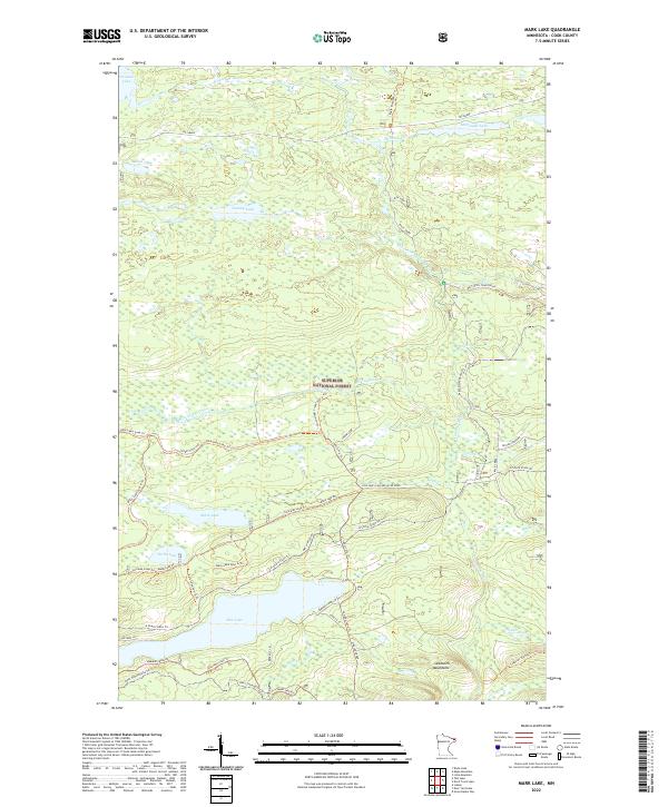
2022 Map of Mark Lake
USGS Topo · Published 2022About this map
Superior National Forest encompasses this stretch of the Sawtooth Mountains, where a network of forest roads and trails reveals a landscape defined by its glacial hydrology and modern recreation. Central to the map, Pike Lake and Mark Lake are connected by specialized routes such as the Mark Lake Spur G Trl and Pike Lake (Cascade River) Road. The presence of Nester Creek Pit suggests local resource extraction for the maintenance of roads like The Grade, which cuts across the northern section near Cascade Lake. This area serves as a significant crossroads for long-distance trekking, featuring both the Superior Hiking Trl and the multi-use N Shore State Trl. Throughout the terrain, smaller waterways like Mississippi Creek and Bally Cr drain the highland ridges toward the Lake Superior basin.
Find a feature on this map
52 named features on this map. Tap any name to fly to it.
Don’t see what you’re looking for? This feature index may not catch every label — zoom into the map to look around manually.
Map Details
Editions of this 2022 Mark Lake Map
This is the sole edition of this map. No revisions or reprints were ever made.
Other maps of this area

1919 · Brule Lake
USGS Topo · 1:62,500

1919 · Grand Marais
USGS Topo · 1:62,500

1919 · Lutsen
USGS Topo · 1:62,500

1954 · Two Harbors
USGS Topo · 1:250,000

1957 · Two Harbors
USGS Topo · 1:250,000

1958 · Two Harbors
USGS Topo · 1:250,000

1958 · Deer Yard Lake
USGS Topo · 1:24,000

1958 · Good Harbor Bay
USGS Topo · 1:24,000

1959 · Lutsen
USGS Topo · 1:24,000

1959 · Lima Mountain
USGS Topo · 1:24,000