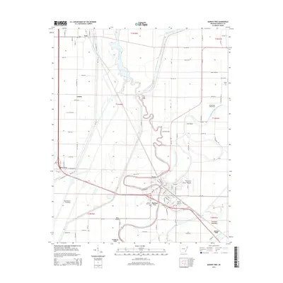
2014 Map of Marked Tree
USGS Topo · Published 2014About this map
The Saint Francis River snakes through the heart of this Poinsett County landscape, defining the character of Marked Tree and its surrounding agricultural plains. The town itself serves as a focal point where the river meets the Left Hand Chute of Little River and the winding Tyronza River further south. This 2014 survey documents the complex water management of the Mississippi Delta, evidenced by the Oak Donnick Floodway and Ditch Number 1. Historical layers are preserved in the locations of the Miller Mound and family-centered sites like Nichols Cem. Small settlements and junction points including Tulot, Cassidy, and Tyronza Junction are mapped alongside local industrial and aviation landmarks like Dewey Mill and the Marked Tree Municipal Airport.
Find a feature on this map
68 named features on this map. Tap any name to fly to it.
Don’t see what you’re looking for? This feature index may not catch every label — zoom into the map to look around manually.
Map Details
Editions of this 2014 Marked Tree Map
This is the sole edition of this map. No revisions or reprints were ever made.
Other maps of this area

1940 · Deckerville
USGS Topo · 1:62,500

1940 · Princedale
USGS Topo · 1:62,500

1940 · Dee
USGS Topo · 1:62,500

1941 · Marked Tree
USGS Topo · 1:62,500

1953 · Memphis
USGS Topo · 1:250,000

1956 · Marked Tree
USGS Topo · 1:62,500

1956 · Memphis
USGS Topo · 1:250,000

1956 · Princedale
USGS Topo · 1:62,500

1957 · Deckerville
USGS Topo · 1:62,500

1958 · Dee
USGS Topo · 1:62,500