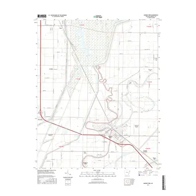
2017 Map of Marked Tree
USGS Topo · Published 2017About this map
The Saint Francis River dominates this portion of the Arkansas Delta, carving a winding path through the Oak Donnick Floodway and the lowlands of Poinsett County. This modern survey illustrates a landscape defined by water management and agricultural engineering, where the river's natural meanders, such as Cahill Bend, contrast with the rigid lines of Ditch Number 1 and various flood control structures. The town of Marked Tree serves as the regional hub, situated at the confluence where the river meets the Left Hand Chute of Little River.
Find a feature on this map
97 named features on this map. Tap any name to fly to it.
Don’t see what you’re looking for? This feature index may not catch every label — zoom into the map to look around manually.
Map Details
Editions of this 2017 Marked Tree Map
This is the sole edition of this map. No revisions or reprints were ever made.
Other maps of this area

1940 · Deckerville
USGS Topo · 1:62,500

1940 · Princedale
USGS Topo · 1:62,500

1940 · Dee
USGS Topo · 1:62,500

1941 · Marked Tree
USGS Topo · 1:62,500

1953 · Memphis
USGS Topo · 1:250,000

1956 · Marked Tree
USGS Topo · 1:62,500

1956 · Memphis
USGS Topo · 1:250,000

1956 · Princedale
USGS Topo · 1:62,500

1957 · Deckerville
USGS Topo · 1:62,500

1958 · Dee
USGS Topo · 1:62,500