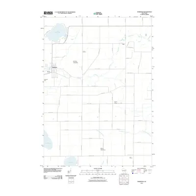
2010 Map of Markesan
USGS Topo · Published 2010About this map
Markesan serves as the primary hub of this Green Lake County landscape, situated where the Grand River meanders through the central terrain. The area is defined by a series of prominent glacial water bodies, including Little Green Lake to the north and Lake Maria and Lake Emily along the southern border. Agricultural and industrial activity is evident through specialized infrastructure like the Del Monte Corporation Landing Strip and the Bosveld Brothers Landing Strip, alongside the established Utley Quarry near the settlement of Utley. Genealogists will find several local burial grounds documented across the townships, from the Memorial Cemetery within the city limits to the more rural Tichora Cemetery, Mackford Union Cemetery, and Kelley Cemetery. This topographic record illustrates a well-organized rural grid where drainage patterns of the South Branch Rock River and Drew Creek influence the local road network and land use during the early 21st century.
Find a feature on this map
45 named features on this map. Tap any name to fly to it.
Don’t see what you’re looking for? This feature index may not catch every label — zoom into the map to look around manually.
Map Details
Editions of this 2010 Markesan Map
This is the sole edition of this map. No revisions or reprints were ever made.
Other maps of this area

1915 · Neshkoro
USGS Topo · 1:48,000

1916 · Ripon
USGS Topo · 1:48,000

1918 · Neshkoro
USGS Topo · 1:62,500

1918 · Ripon
USGS Topo · 1:62,500

1955 · Randolph
USGS Topo · 1:62,500

1955 · Fox Lake
USGS Topo · 1:62,500

1956 · Ripon
USGS Topo · 1:62,500

1957 · Madison
USGS Topo · 1:250,000

1960 · Madison
USGS Topo · 1:250,000

1963 · Neshkoro
USGS Topo · 1:62,500