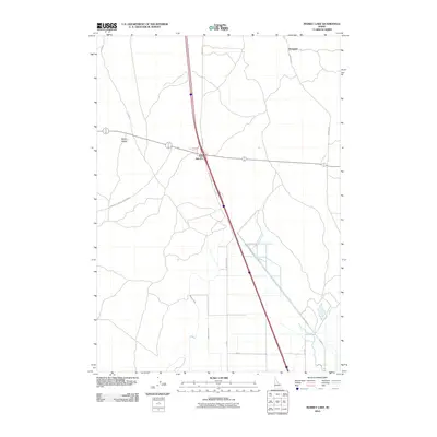
2010 Map of Market Lake
USGS Topo · Published 2010About this map
Sage Junction serves as the primary crossroads in this portion of the Snake River Plain, where the transit corridors of Old Hwy 91 and modern interstate routes intersect. The landscape is defined by the rigid geometry of agricultural development and water management, evidenced by the Robison Canal and Bolt Larsen Canal that feed the surrounding fields. To the north, the small settlement of Hawgood sits along a network of rural roads such as Redwood Rd and Blue Stem Rd. One of the few natural topographic breaks in this terrain is the curiously named Mollys Nipple, a distinct landmark rising above the flat valley floor. This survey documents the area's infrastructure as of 2010, tracing the evolution of regional travel from early county roads like Twin Butte Sage Junction Rd to the established grid system.
Find a feature on this map
13 named features on this map. Tap any name to fly to it.
Don’t see what you’re looking for? This feature index may not catch every label — zoom into the map to look around manually.
Map Details
Editions of this 2010 Market Lake Map
This is the sole edition of this map. No revisions or reprints were ever made.
Other maps of this area

1948 · Lewisville
USGS Topo · 1:24,000

1949 · Lewisville
USGS Topo · 1:24,000

1949 · Roberts
USGS Topo · 1:62,500

1949 · Roberts
USGS Topo · 1:24,000

1950 · Roberts
USGS Topo · 1:24,000

1955 · Idaho Falls
USGS Topo · 1:250,000

1958 · Idaho Falls
USGS Topo · 1:250,000

1964 · Kettle Butte NE
USGS Topo · 1:24,000
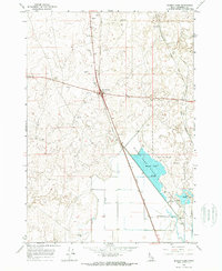
1964 · Market Lake
USGS Topo · 1:24,000
1964 · Deer Parks
USGS Topo · 1:24,000