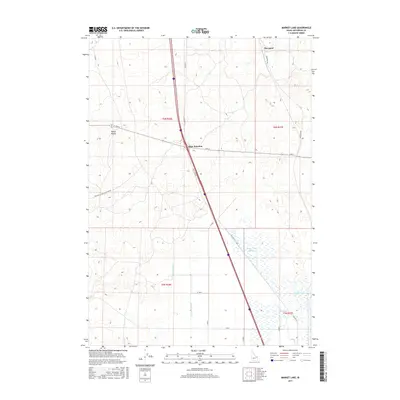
2017 Map of Market Lake
USGS Topo · Published 2017About this map
Market Lake and the adjacent Market Lake Slough dominate the southeastern portion of this Jefferson County landscape, highlighting a complex wetland system that has long influenced local movement and agriculture. The intersection of modern transportation and early settlement is evident at Sage Junction, where the north-south interstate corridor meets east-west routes like Twin Butte Sage Junction Rd. To the north, the small settlement of Hawgood sits along the path of Old Hwy 91, representing the evolution of regional transit from historical highways to modern expressways.
Find a feature on this map
23 named features on this map. Tap any name to fly to it.
Don’t see what you’re looking for? This feature index may not catch every label — zoom into the map to look around manually.
Map Details
Editions of this 2017 Market Lake Map
This is the sole edition of this map. No revisions or reprints were ever made.
Other maps of this area

1948 · Lewisville
USGS Topo · 1:24,000

1949 · Lewisville
USGS Topo · 1:24,000

1949 · Roberts
USGS Topo · 1:62,500

1949 · Roberts
USGS Topo · 1:24,000

1950 · Roberts
USGS Topo · 1:24,000

1955 · Idaho Falls
USGS Topo · 1:250,000

1958 · Idaho Falls
USGS Topo · 1:250,000

1964 · Kettle Butte NE
USGS Topo · 1:24,000
1964 · Market Lake
USGS Topo · 1:24,000
1964 · Deer Parks
USGS Topo · 1:24,000