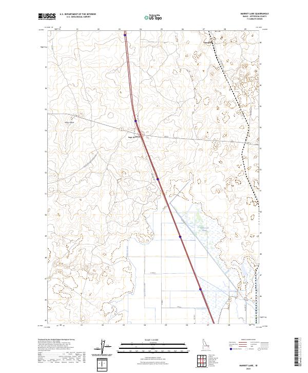
2023 Map of Market Lake
USGS Topo · Published 2023About this map
Sage Junction serves as a focal point for this high-desert portion of Jefferson County, where modern highway routes intersect against a backdrop of historic irrigation infrastructure. The landscape is defined by its water management systems, notably the Bell Larsen Canal and Robison Canal, which channel resources through the arid terrain. To the east, the Market Lake Slough provides a stark contrast to the surrounding agricultural grid, indicating the complex hydrology of the Snake River Plain. Geologic features like Mollys Nipple rise above the basin, while the settlement of Hawgood and the corridor of Old Hwy 91 reflect the region's long-standing role as a transit path through eastern Idaho.
Find a feature on this map
21 named features on this map. Tap any name to fly to it.
Don’t see what you’re looking for? This feature index may not catch every label — zoom into the map to look around manually.
Map Details
Editions of this 2023 Market Lake Map
This is the sole edition of this map. No revisions or reprints were ever made.
Other maps of this area

1948 · Lewisville
USGS Topo · 1:24,000

1949 · Lewisville
USGS Topo · 1:24,000

1949 · Roberts
USGS Topo · 1:62,500

1949 · Roberts
USGS Topo · 1:24,000

1950 · Roberts
USGS Topo · 1:24,000

1955 · Idaho Falls
USGS Topo · 1:250,000

1958 · Idaho Falls
USGS Topo · 1:250,000

1964 · Kettle Butte NE
USGS Topo · 1:24,000
1964 · Market Lake
USGS Topo · 1:24,000
1964 · Deer Parks
USGS Topo · 1:24,000