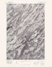
1976 Map of Markham SE
USGS Topo · Published 1979About this map
North Branch Whiteface River and the South Branch Whiteface River dominate this orthophotoquad, which provides a high-altitude perspective of the northern Minnesota landscape as it appeared in May 1976. Unlike a traditional topographic map, this photographic record captures the raw texture of the wetlands, forests, and winding watercourses of St. Louis County with striking clarity. The meandering paths of the river branches reveal the natural hydrology of the region, showing how the water cuts through the dense vegetation and glacial terrain typical of this part of the state. These aerial images are particularly useful for researchers studying environmental changes or land use patterns in the late 1970s, offering a visual benchmark of the area's geography before decades of further natural and human-driven development.
Find a feature on this map
2 named features on this map. Tap any name to fly to it.
Don’t see what you’re looking for? This feature index may not catch every label — zoom into the map to look around manually.
Map Details
Editions of this 1976 Markham SE Map
This is the sole edition of this map. No revisions or reprints were ever made.
Other maps of this area

1954 · Two Harbors
USGS Topo · 1:250,000

1954 · Hibbing
USGS Topo · 1:250,000

1956 · Pequaywan Lake
USGS Topo · 1:24,000

1957 · Two Harbors
USGS Topo · 1:250,000

1957 · Hibbing
USGS Topo · 1:250,000

1957 · Brimson
USGS Topo · 1:62,500

1957 · Markham
USGS Topo · 1:62,500

1957 · Comstock Lake
USGS Topo · 1:24,000
1957 · Boulder Lake Reservoir NE
USGS Topo · 1:24,000

1958 · Hibbing
USGS Topo · 1:250,000