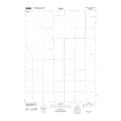
2010 Map of Marks Butte
USGS Topo · Published 2010About this map
Sunrise School serves as a historical focal point in this portion of Sedgwick County, where the landscape is defined by a precise grid of rural infrastructure. The map illustrates a high plains environment dominated by large-scale agricultural holdings and ranching operations, such as Price Ranch. This area of eastern Colorado is characterized by its organized transport network, where north-south routes like County Rd 9 and County Rd 15 intersect with east-west thoroughfares to facilitate travel between remote ranch sites and regional centers. The most prominent natural landmark is the topographic rise of Marks Butte on the eastern side of the quadrangle. The map captures the quiet, expansive nature of the region as it appeared during the first decade of the 21st century, prior to modern intensive developments.
Find a feature on this map
17 named features on this map. Tap any name to fly to it.
Don’t see what you’re looking for? This feature index may not catch every label — zoom into the map to look around manually.
Map Details
Editions of this 2010 Marks Butte Map
This is the sole edition of this map. No revisions or reprints were ever made.
Other maps of this area

1952 · Julesburg SW
USGS Topo · 1:24,000

1952 · Marks Butte
USGS Topo · 1:24,000

1953 · Ovid
USGS Topo · 1:24,000

1953 · Tamarack Ranch
USGS Topo · 1:24,000

1953 · Julesburg Reservoir
USGS Topo · 1:24,000

1953 · Sedgwick
USGS Topo · 1:24,000

1954 · Sterling
USGS Topo · 1:250,000

1958 · Sterling
USGS Topo · 1:250,000

1962 · Haxtun East
USGS Topo · 1:24,000

1962 · Haxtun West
USGS Topo · 1:24,000