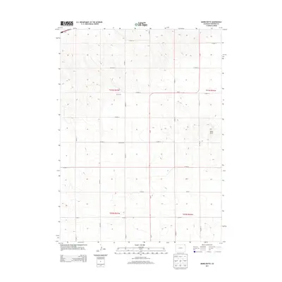
2013 Map of Marks Butte
USGS Topo · Published 2013About this map
Sunrise School stands as a focal point in this portion of northeastern Colorado, situated in a landscape defined by the regular geometry of the Public Land Survey System. The area is characterized by an extensive network of rural routes, including Co Road 14 and Co-59, which facilitate movement across the agricultural terrain. The map captures the agricultural footprint of the early 21st century, punctuated by local landmarks like the Price Ranch and the distinct topographic rise of Marks Butte in the eastern section. This 2013 survey illustrates the enduring rural character of Sedgwick County, where section lines and county roads dictate the pattern of settlement and land use, preserving a record of the community infrastructure and named family holdings that have shaped the high plains.
Find a feature on this map
22 named features on this map. Tap any name to fly to it.
Don’t see what you’re looking for? This feature index may not catch every label — zoom into the map to look around manually.
Map Details
Editions of this 2013 Marks Butte Map
This is the sole edition of this map. No revisions or reprints were ever made.
Other maps of this area

1952 · Julesburg SW
USGS Topo · 1:24,000

1952 · Marks Butte
USGS Topo · 1:24,000

1953 · Ovid
USGS Topo · 1:24,000

1953 · Tamarack Ranch
USGS Topo · 1:24,000

1953 · Julesburg Reservoir
USGS Topo · 1:24,000

1953 · Sedgwick
USGS Topo · 1:24,000

1954 · Sterling
USGS Topo · 1:250,000

1958 · Sterling
USGS Topo · 1:250,000

1962 · Haxtun East
USGS Topo · 1:24,000

1962 · Haxtun West
USGS Topo · 1:24,000