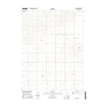
2016 Map of Marks Butte
USGS Topo · Published 2016About this map
Marks Butte serves as a prominent landmark in this northeastern corner of Colorado, where the high plains are defined by a meticulous grid of rural section lines and county roads. The landscape is organized into townships including t10n r47w and t9n r46w, reflecting the long-standing Public Land Survey System that governs this agricultural region. Transportation across these plains relies on a network of straight-line connectors such as Co Rd 18, Co Rd 14, and Co Rd 10, which trace the borders of large-scale farming and ranching operations. The terrain is characterized by subtle elevation shifts and draws that break the otherwise uniform geometry of the county road system, providing a clear record of land division and rural infrastructure in Sedgwick County as it existed in the early 21st century.
Find a feature on this map
17 named features on this map. Tap any name to fly to it.
Don’t see what you’re looking for? This feature index may not catch every label — zoom into the map to look around manually.
Map Details
Editions of this 2016 Marks Butte Map
This is the sole edition of this map. No revisions or reprints were ever made.
Other maps of this area

1952 · Julesburg SW
USGS Topo · 1:24,000

1952 · Marks Butte
USGS Topo · 1:24,000

1953 · Ovid
USGS Topo · 1:24,000

1953 · Tamarack Ranch
USGS Topo · 1:24,000

1953 · Julesburg Reservoir
USGS Topo · 1:24,000

1953 · Sedgwick
USGS Topo · 1:24,000

1954 · Sterling
USGS Topo · 1:250,000

1958 · Sterling
USGS Topo · 1:250,000

1962 · Haxtun East
USGS Topo · 1:24,000

1962 · Haxtun West
USGS Topo · 1:24,000