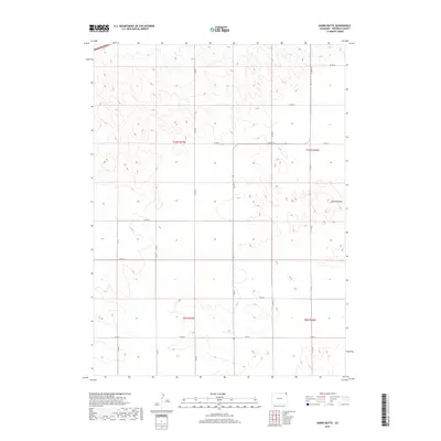
2019 Map of Marks Butte
USGS Topo · Published 2019About this map
Marks Butte stands as a prominent elevation in this corner of the High Plains, where the landscape is meticulously organized by the Public Land Survey System. The map details a region defined by a rigid grid of agricultural transportation, dominated by county routes such as Co Rd 14 and Co Rd 11. These roads follow section lines across township boundaries, specifically t10n r47w and t10n r46w, illustrating the late-modern rural infrastructure of the Colorado plains. The absence of concentrated settlements highlights the area's specialized land use, where long-distance routes like Co Rd 5 and Co Rd 9 facilitate movement through large-scale ranching or farming tracts. This cartographic record provides a precise look at the elevation contours and surveyed boundaries that dictate land ownership and access in Sedgwick County.
Find a feature on this map
18 named features on this map. Tap any name to fly to it.
Don’t see what you’re looking for? This feature index may not catch every label — zoom into the map to look around manually.
Map Details
Editions of this 2019 Marks Butte Map
This is the sole edition of this map. No revisions or reprints were ever made.
Other maps of this area

1952 · Julesburg SW
USGS Topo · 1:24,000

1952 · Marks Butte
USGS Topo · 1:24,000

1953 · Ovid
USGS Topo · 1:24,000

1953 · Tamarack Ranch
USGS Topo · 1:24,000

1953 · Julesburg Reservoir
USGS Topo · 1:24,000

1953 · Sedgwick
USGS Topo · 1:24,000

1954 · Sterling
USGS Topo · 1:250,000

1958 · Sterling
USGS Topo · 1:250,000

1962 · Haxtun East
USGS Topo · 1:24,000

1962 · Haxtun West
USGS Topo · 1:24,000