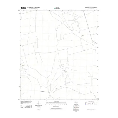
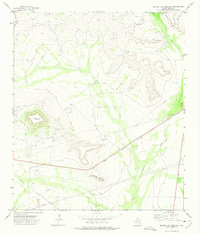
2010 Map of Marlboro Canyon
USGS Topo · Published 2010About this map
Willrode Oil Field and Heluma Oil Field anchor this 2010 landscape of Upton County, where energy extraction and ranching define the geography of the Permian Basin. The terrain is dominated by the dramatic rise of King Mountain and the carving of Marlboro Canyon, features that dictate the sparse but essential road network including RD 495 and Co RD 490. Isolated landmarks like the Eddelman Windmill and Mountain Pasture Windmill point to the enduring presence of cattle ranching alongside the more modern infrastructure of the King Mountain Oil Field. The intermittent drainage of Mayfield Draw cuts through the northern reaches of the quadrangle, illustrating the arid hydrology of West Texas. This survey provides a clear view of the intersection between traditional land use and the intensive infrastructure of the Texas oil industry.
Find a feature on this map
14 named features on this map. Tap any name to fly to it.
Don’t see what you’re looking for? This feature index may not catch every label — zoom into the map to look around manually.
Map Details
Editions of this 2010 Marlboro Canyon Map
This is the sole edition of this map. No revisions or reprints were ever made.
Other maps of this area

1928 · Crane
USGS Topo · 1:125,000

1954 · Pecos
USGS Topo · 1:250,000

1957 · Pecos
USGS Topo · 1:250,000
1971 · Hanks Ranch
USGS Topo · 1:24,000

1971 · McElroy Ranch
USGS Topo · 1:24,000
1971 · Marlboro Canyon SE
USGS Topo · 1:24,000

1971 · Marlboro Canyon
USGS Topo · 1:24,000

1972 · Girvin NE
USGS Topo · 1:24,000
1972 · McCamey North
USGS Topo · 1:24,000
1972 · Square Top Mountain
USGS Topo · 1:24,000