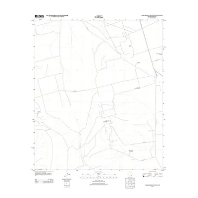
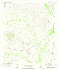
2012 Map of Marlboro Canyon
USGS Topo · Published 2012About this map
Marlboro Canyon and its surrounding high plains landscape define this section of Upton County, where a network of industry-linked infrastructure supports the region's energy and ranching sectors. The terrain is marked by significant petroleum activity, notably at the Willrode Oil Field, Heluma Oil Field, and King Mountain Oil Field. This infrastructure is complemented by a series of specialized landmarks like the Eighthundred Acre Windmill and Eddelman Windmill, which speak to the essential water management required in this arid environment. Transportation across the territory is facilitated by a grid of rural routes including Ranch Road 2463, Road 495, and Hunt Oil Rd, which connect the scattered oil operations and grazing lands to the larger regional trade network.
Find a feature on this map
16 named features on this map. Tap any name to fly to it.
Don’t see what you’re looking for? This feature index may not catch every label — zoom into the map to look around manually.
Map Details
Editions of this 2012 Marlboro Canyon Map
This is the sole edition of this map. No revisions or reprints were ever made.
Other maps of this area

1928 · Crane
USGS Topo · 1:125,000

1954 · Pecos
USGS Topo · 1:250,000

1957 · Pecos
USGS Topo · 1:250,000
1971 · Hanks Ranch
USGS Topo · 1:24,000

1971 · McElroy Ranch
USGS Topo · 1:24,000
1971 · Marlboro Canyon SE
USGS Topo · 1:24,000

1971 · Marlboro Canyon
USGS Topo · 1:24,000

1972 · Girvin NE
USGS Topo · 1:24,000
1972 · McCamey North
USGS Topo · 1:24,000
1972 · Square Top Mountain
USGS Topo · 1:24,000