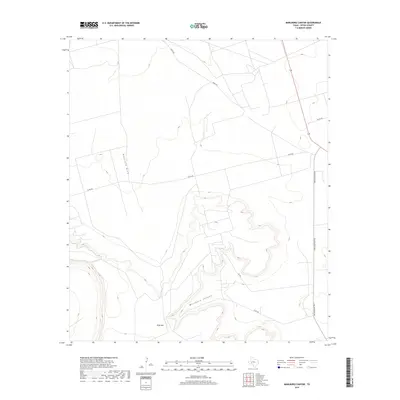
2019 Map of Marlboro Canyon
USGS Topo · Published 2019About this map
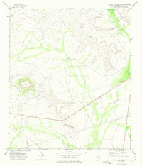
King Mtn dominates this portion of the Edwards Plateau in Upton County, its steep escarpments dropping into the winding depths of Marlboro Canyon. The landscape is defined by the stark transition from high, flat-topped mesas to the ephemeral drainage of Mayfield Draw in the west. Modern transit follows historical patterns along the periphery, with King Mountain Rd skirting the eastern edge of the elevated terrain while Ranch Rd and various county routes provide access to the expansive ranchlands. The contouring reveals the intricate network of finger canyons and draws that have shaped the livestock-rearing economy of this West Texas region, illustrating the topographic challenges faced by early settlers and contemporary land managers alike.
Find a feature on this map
10 named features on this map. Tap any name to fly to it.
Don’t see what you’re looking for? This feature index may not catch every label — zoom into the map to look around manually.
Map Details
Editions of this 2019 Marlboro Canyon Map
This is the sole edition of this map. No revisions or reprints were ever made.
Other maps of this area

1928 · Crane
USGS Topo · 1:125,000

1954 · Pecos
USGS Topo · 1:250,000

1957 · Pecos
USGS Topo · 1:250,000
1971 · Hanks Ranch
USGS Topo · 1:24,000

1971 · McElroy Ranch
USGS Topo · 1:24,000
1971 · Marlboro Canyon SE
USGS Topo · 1:24,000

1971 · Marlboro Canyon
USGS Topo · 1:24,000

1972 · Girvin NE
USGS Topo · 1:24,000
1972 · McCamey North
USGS Topo · 1:24,000
1972 · Square Top Mountain
USGS Topo · 1:24,000