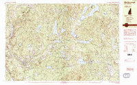
1984 Map of Marlborough
USGS Topo · Published 1984About this map
Marlborough and Harrisville anchor this 1984 survey of the Monadnock region, a landscape defined by an intricate network of highland reservoirs and granite peaks. The map reveals the area's transition from an industrial past to a residential and recreational character, featuring the prominent Harrisville Pond and Skatutakee Lake which once powered local mills. Landmarks such as the St Francis Ch and Pine Grove Cem in Marlborough offer key points for genealogical research, while the Quarry south of town indicates the enduring importance of stone extraction in this part of Cheshire County.
Find a feature on this map
86 named features on this map. Tap any name to fly to it.
Don’t see what you’re looking for? This feature index may not catch every label — zoom into the map to look around manually.
Map Details
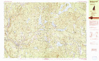
Editions of this 1984 Marlborough Map
2 editions found
Other maps of this area

1898 · Monadnock
USGS Topo · 1:62,500

1898 · Keene
USGS Topo · 1:62,500

1900 · Peterboro
USGS Topo · 1:62,500

1926 · Hillsboro
USGS Topo · 1:62,500

1927 · Bellows Falls
USGS Topo · 1:48,000

1929 · Hillsboro
USGS Topo · 1:62,500

1930 · Lovewell Mountain
USGS Topo · 1:62,500

1930 · Bellows Falls
USGS Topo · 1:62,500

1932 · Keene
USGS Topo · 1:62,500
1935 · Keene
USGS Topo · 1:62,500