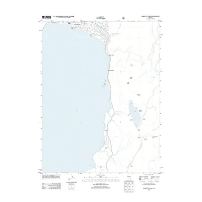
2012 Map of Marlette Lake
USGS Topo · Published 2012About this map
Incline Village sits at the northern edge of this Lake Tahoe shoreline, where residential developments like Lakeshore Blvd and Mill Creek Rd meet the water at Crystal Bay. The map documents a significant high-altitude hydrological system, centered on the Marlette Lake and Marlette Reservoir basin. This area is characterized by steep elevation gains towards Marlette Peak and Snow Valley Peak, with numerous drainages such as North Canyon Creek and Ash Canyon Creek flowing from the Sierra Nevada crest. The map details the modern transition from the lakeside community near the Incline Village Branch Post Office to the protected public lands and recreational points of interest like Sand Harbor and Memorial Point.
Find a feature on this map
45 named features on this map. Tap any name to fly to it.
Don’t see what you’re looking for? This feature index may not catch every label — zoom into the map to look around manually.
Map Details
Editions of this 2012 Marlette Lake Map
This is the sole edition of this map. No revisions or reprints were ever made.
Other maps of this area

1891 · Carson
USGS Topo · 1:125,000

1891 · Truckee
USGS Topo · 1:125,000

1893 · Carson
USGS Topo · 1:125,000

1893 · Truckee
USGS Topo · 1:125,000

1895 · Truckee
USGS Topo · 1:125,000

1932 · Truckee
USGS Topo · 1:96,000

1940 · Truckee
USGS Topo · 1:125,000

1950 · Mt. Rose
USGS Topo · 1:62,500

1952 · Mt. Rose
USGS Topo · 1:62,500
1955 · Meeks Bay
USGS Topo · 1:24,000