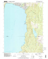
1992 Map of Marlette Lake
USGS Topo · Published 1994About this map
Incline Village serves as the primary hub along the northeastern shore of Lake Tahoe in this early 1990s revision. The shoreline topography is marked by distinctive coves and landings, including Sand Harbor, Secret Harbor, and Skunk Harbor, reflecting the region's development as a major recreation destination. Education and leisure are prominent, with Incline Sch, Incline Middle Sch, and the Diamond Peak Sky Resort all situated within the mountainous terrain overlooking Crystal Bay.
Find a feature on this map
40 named features on this map. Tap any name to fly to it.
Don’t see what you’re looking for? This feature index may not catch every label — zoom into the map to look around manually.
Map Details
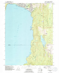
Editions of this 1992 Marlette Lake Map
2 editions found
Other maps of this area

1891 · Carson
USGS Topo · 1:125,000

1891 · Truckee
USGS Topo · 1:125,000

1893 · Carson
USGS Topo · 1:125,000

1893 · Truckee
USGS Topo · 1:125,000

1895 · Truckee
USGS Topo · 1:125,000

1932 · Truckee
USGS Topo · 1:96,000

1940 · Truckee
USGS Topo · 1:125,000

1950 · Mt. Rose
USGS Topo · 1:62,500

1952 · Mt. Rose
USGS Topo · 1:62,500
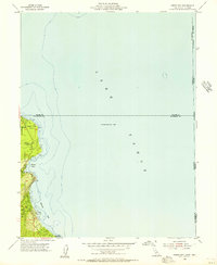
1955 · Meeks Bay
USGS Topo · 1:24,000