
1940 Map of Marmaduke
USGS Topo · Published 1942About this map
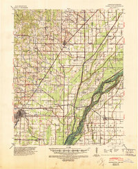
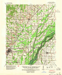
Paragould anchors the southwestern corner of this survey, a significant rail and commercial hub where the St Louis Southwestern Railway cuts through the lowlands. The landscape is defined by an intricate network of drainage and natural waterways, including the St Francis River and the complex system of sloughs like Big Slough and Mud Slough that once necessitated numerous "island" formations such as Indian Hill Island and Lower Panther Island. These elevated areas provided critical dry ground for early rural settlements and small farms.
Find a feature on this map
103 named features on this map. Tap any name to fly to it.
Don’t see what you’re looking for? This feature index may not catch every label — zoom into the map to look around manually.
Map Details
Editions of this 1940 Marmaduke Map
3 editions found
Other maps of this area

1934 · Kennett
USGS Topo · 1:62,500

1935 · Rector
USGS Topo · 1:62,500

1935 · Knobel
USGS Topo · 1:62,500

1939 · Jonesboro
USGS Topo · 1:62,500

1940 · Gainesville
USGS Topo · 1:62,500

1940 · Kennett
USGS Topo · 1:62,500

1940 · Piggott
USGS Topo · 1:62,500

1941 · Leachville
USGS Topo · 1:62,500

1941 · Manila
USGS Topo · 1:62,500

1941 · Knobel
USGS Topo · 1:62,500