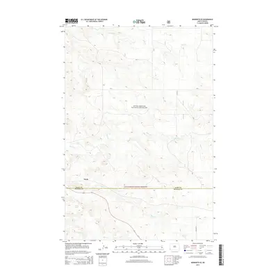
2014 Map of Marmarth SE
USGS Topo · Published 2014About this map
The settlement of Mazda sits at the heart of this landscape in the southwestern corner of North Dakota, where the prairies of the Little Missouri National Grassland dominate the terrain. A complex system of seasonal drainages and creek beds, including Indian Cr, Bacon Cr, and Hay Cr, define the topography of the region, revealing the erosive forces acting upon the high plains. The map captures a transition point at the border between Slope County and Bowman County, showing how early 21st-century infrastructure like Us-12 and 163rd Ave SW cuts through the wide-open reaches. Geographic landmarks such as Dickey Draw and Worser Cr provide specific points of reference for land use and local navigation in an area characterized by its sparse human footprint and managed public lands.
Find a feature on this map
11 named features on this map. Tap any name to fly to it.
Don’t see what you’re looking for? This feature index may not catch every label — zoom into the map to look around manually.
Map Details
Editions of this 2014 Marmarth SE Map
This is the sole edition of this map. No revisions or reprints were ever made.
Other maps of this area

1953 · Dickinson
USGS Topo · 1:250,000

1957 · Dickinson
USGS Topo · 1:250,000

1973 · Kid Creek
USGS Topo · 1:24,000

1973 · Cedar Hills
USGS Topo · 1:24,000

1973 · Rhame
USGS Topo · 1:24,000

1979 · Ives
USGS Topo · 1:24,000

1980 · Pretty Butte
USGS Topo · 1:24,000

1980 · Marmarth
USGS Topo · 1:24,000

1980 · Boyce Creek West
USGS Topo · 1:24,000

1981 · Bowman
USGS Topo · 1:100,000