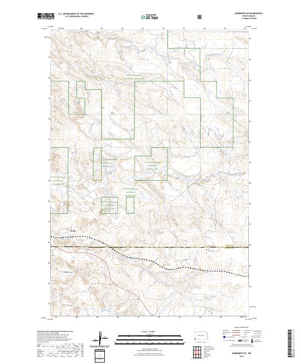
2024 Map of Marmarth SE
USGS Topo · Published 2024About this map
Little Missouri National Grassland dominates the high plains landscape of southwestern North Dakota in this recent survey. The terrain is defined by dramatic drainage patterns, including the winding course of Indian Creek in the north and Hay Creek through the center, eventually descending into Dickey Draw. Evidence of the region's pioneering history is centered around the Fort and Dilts Cem near the southern boundary line between Slope and Bowman counties. A network of rural roads like Fort Dilts Rd and 76th St SW provides access to these isolated sites. The small settlement of Mazda sits nestled in the western reaches of the quadrangle, illustrating the sparse but enduring human footprint in this section of the Badlands. The map provides a precise record of contemporary land management boundaries across multiple townships.
Find a feature on this map
17 named features on this map. Tap any name to fly to it.
Don’t see what you’re looking for? This feature index may not catch every label — zoom into the map to look around manually.
Map Details
Editions of this 2024 Marmarth SE Map
This is the sole edition of this map. No revisions or reprints were ever made.
Other maps of this area

1953 · Dickinson
USGS Topo · 1:250,000

1957 · Dickinson
USGS Topo · 1:250,000

1973 · Kid Creek
USGS Topo · 1:24,000

1973 · Cedar Hills
USGS Topo · 1:24,000

1973 · Rhame
USGS Topo · 1:24,000

1979 · Ives
USGS Topo · 1:24,000

1980 · Pretty Butte
USGS Topo · 1:24,000

1980 · Marmarth
USGS Topo · 1:24,000

1980 · Boyce Creek West
USGS Topo · 1:24,000

1981 · Bowman
USGS Topo · 1:100,000