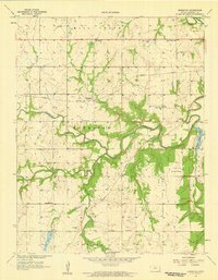
1958 Map of Marmaton
USGS Topo · Published 1959About this map
The Marmaton River and the Missouri Pacific railroad define this Kansas landscape, where small agricultural settlements like Marmaton and Hollister anchored the rural community in the late 1950s. The survey reveals a dense network of country education, marking the positions of Bethel Sch, West Plains Sch, and Union Bend Sch, alongside the Marmaton Cem and Pleasant Valley Ch. Significant infrastructure of the era is present, including the Fort Scott Municipal Airport and recreational sites such as Elm Creek Lake and Rock Creek Lake. A notable historical detail is the Old Indian Boundary line crossing the southern portion of the map, providing a glimpse into the earlier division of Kansas lands. The topography is further characterized by numerous watercourses such as Cedar Creek, Point Creek, and Pawnee Creek.
Find a feature on this map
27 named features on this map. Tap any name to fly to it.
Don’t see what you’re looking for? This feature index may not catch every label — zoom into the map to look around manually.
Map Details
Editions of this 1958 Marmaton Map
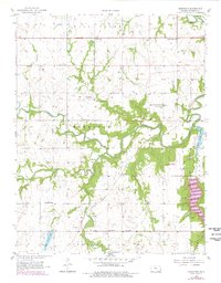
2 editions found
Other maps of this area

1884 · Fort Scott
USGS Topo · 1:125,000

1886 · Fort Scott
USGS Topo · 1:125,000

1893 · Fort Scott
USGS Topo · 1:125,000

1947 · Joplin
USGS Topo · 1:250,000

1948 · Mulberry
USGS Topo · 1:62,500

1948 · Girard
USGS Topo · 1:62,500
1949 · Girard
USGS Topo · 1:62,500

1949 · Joplin
USGS Topo · 1:250,000
1950 · Mulberry
USGS Topo · 1:62,500

1954 · Joplin
USGS Topo · 1:250,000