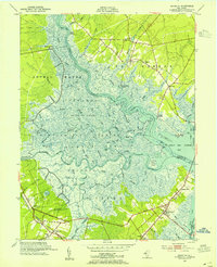
1952 Map of Marmora
USGS Topo · Published 1955About this map
The Great Egg Harbor River and the Tuckahoe River converge in a labyrinth of tidal marshes and winding thoroughfares, defining the boundary between Atlantic and Cape May counties. In the early 1950s, the landscape remained dominated by expansive wetlands like Griscom Swamp and the Cedar Swamp, broken only by small landings and riverside settlements. Beesleys Point serves as a critical junction for travel across the bay, while the Pennsylvania - Reading Seashore Lines cuts through the southwestern corner near Petersburg. Local life is anchored by traditional institutions such as Palestine Ch, Asbury Ch, and the Marmora School. The map reveals a delicate balance between the natural flow of tidal waters, such as Ludlam Thorofare, and the emerging infrastructure of Roosevelt Blvd, illustrating a coastal region at the threshold of modern development.
Find a feature on this map
71 named features on this map. Tap any name to fly to it.
Don’t see what you’re looking for? This feature index may not catch every label — zoom into the map to look around manually.
Map Details
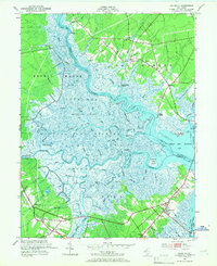
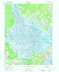
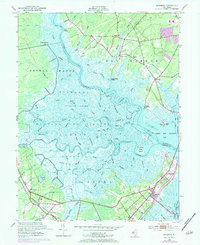
Editions of this 1952 Marmora Map
4 editions found
Other maps of this area

1884 · Sea Isle
USGS Topo · 1:62,500

1888 · Dennisville
USGS Topo · 1:62,500

1888 · Sea Isle
USGS Topo · 1:62,500

1890 · Great Egg Harbor
USGS Topo · 1:62,500

1890 · Tuckahoe
USGS Topo · 1:62,500

1893 · Great Egg Harbor
USGS Topo · 1:62,500

1893 · Tuckahoe
USGS Topo · 1:62,500

1894 · Dennisville
USGS Topo · 1:62,500

1894 · Sea Isle
USGS Topo · 1:62,500

1918 · Great Egg Harbor
USGS Topo · 1:62,500