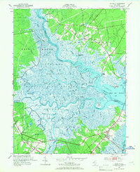
1952 Map of Marmora
USGS Topo · Published 1966About this map
Great Egg Harbor River carves a winding path through this mid-century coastal landscape, serving as a primary artery between the dense wetlands of Griscom Swamp and the open waters of Great Egg Harbor Bay. The map captures a transition period for Atlantic and Cape May counties, where the traditional river-oriented settlements like Scullville, English Creek, and Jeffers Landing maintained their character alongside emerging road networks.
Find a feature on this map
69 named features on this map. Tap any name to fly to it.
Don’t see what you’re looking for? This feature index may not catch every label — zoom into the map to look around manually.
Map Details
Editions of this 1952 Marmora Map
4 editions found
Other maps of this area

1884 · Sea Isle
USGS Topo · 1:62,500

1888 · Dennisville
USGS Topo · 1:62,500

1888 · Sea Isle
USGS Topo · 1:62,500

1890 · Great Egg Harbor
USGS Topo · 1:62,500

1890 · Tuckahoe
USGS Topo · 1:62,500

1893 · Great Egg Harbor
USGS Topo · 1:62,500

1893 · Tuckahoe
USGS Topo · 1:62,500

1894 · Dennisville
USGS Topo · 1:62,500

1894 · Sea Isle
USGS Topo · 1:62,500

1918 · Great Egg Harbor
USGS Topo · 1:62,500