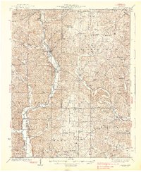
1938 Map of Marquand
USGS Topo · Published 1938About this map
Marquand sits at the heart of this survey, where the Castor River and the Missouri Pacific railroad define the local geography. The landscape is a network of small settlements like Bessville and Glenallen, connected by a density of country institutions that suggest a vibrant rural life in the 1930s. Dozens of one-room schoolhouses, including Tiptop Sch and Moore Sch, are scattered across the hills alongside family landmarks like the Mouser Cem and Rhodes Chapel.
Find a feature on this map
87 named features on this map. Tap any name to fly to it.
Don’t see what you’re looking for? This feature index may not catch every label — zoom into the map to look around manually.
Map Details
Editions of this 1938 Marquand Map
2 editions found

Other maps of this area

1910 · Higdon
USGS Topo · 1:62,500

1923 · Perryville
USGS Topo · 1:62,500

1924 · Perryville
USGS Topo · 1:62,500

1930 · Coldwater
USGS Topo · 1:62,500

1933 · Marble Hill
USGS Topo · 1:62,500

1933 · Marquand
USGS Topo · 1:62,500

1934 · Greenville
USGS Topo · 1:62,500

1934 · Advance
USGS Topo · 1:62,500

1935 · Zalma
USGS Topo · 1:62,500

1937 · Marble Hill
USGS Topo · 1:62,500