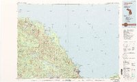
1985 Map of Marquette
USGS Topo · Published 1991About this map
The Huron Mountains dominate the western horizon of this mid-1980s coastal study, giving way to the vast expanse of Lake Superior. The landscape reflects a legacy of extraction and infrastructure, from the iron-rich industrial centers of Ishpeming and Negaunee to the active North Lake Mine. Along the shoreline, Marquette serves as the regional anchor, where the Marquette State Prison and Presque Isle frame the harbor's edge.
Find a feature on this map
93 named features on this map. Tap any name to fly to it.
Don’t see what you’re looking for? This feature index may not catch every label — zoom into the map to look around manually.
Map Details
Editions of this 1985 Marquette Map
3 editions found
Other maps of this area

1899 · Witbeck
USGS Topo · 1:62,500

1907 · Marquette
USGS Topo · 1:62,500

1932 · Harvey NW
USGS Topo · 1:31,680

1932 · Skandia NE
USGS Topo · 1:31,680

1932 · Harvey NE
USGS Topo · 1:31,680

1950 · Skandia NW
USGS Topo · 1:31,680

1952 · Sands
USGS Topo · 1:24,000

1952 · Ishpeming
USGS Topo · 1:62,500

1952 · Ishpeming
USGS Topo · 1:24,000

1952 · Gwinn
USGS Topo · 1:62,500