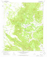
1961 Map of Marquez
USGS Topo · Published 1978About this map
Marquez sits at the heart of this high-desert landscape, tucked near the Arroyo Hondo where the Sandoval and Valencia county lines meet. The terrain is defined by the massive Cebolleta plateau, which falls away into a complex system of canyons like the Cañon de Marquez and the deep Cañon Seco. This 1961 survey provides a look at a ranching landscape reliant on dispersed water sources, including Ojo San Mateo and Diablo Spring. Notable landmarks like Las Cuevas de Marquez and the Cueva de los Novios suggest a geography shaped by both natural features and long-established local lore. The presence of several bridges, such as the Gallegos Bridge and Puerto Bridge, highlights the critical travel routes through these canyons before modern infrastructure bypassed many of these remote settlements.
Find a feature on this map
61 named features on this map. Tap any name to fly to it.
Don’t see what you’re looking for? This feature index may not catch every label — zoom into the map to look around manually.
Map Details
Editions of this 1961 Marquez Map
2 editions found
Other maps of this area

1883 · Mt. Taylor
USGS Topo · 1:250,000

1886 · Mt. Taylor
USGS Topo · 1:250,000

1892 · Mt. Taylor
USGS Topo · 1:250,000

1899 · Mt. Taylor
USGS Topo · 1:250,000

1957 · Moquino
USGS Topo · 1:24,000

1957 · Seboyeta
USGS Topo · 1:24,000
1957 · Arch Mesa
USGS Topo · 1:24,000

1958 · Albuquerque
USGS Topo · 1:250,000

1961 · Marquez
USGS Topo · 1:24,000

1961 · Cerro Tinaja
USGS Topo · 1:24,000