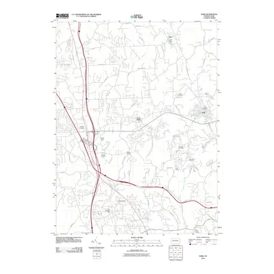
2010 Map of Mars
USGS Topo · Published 2010About this map
Mars and the surrounding Butler County landscape appear here in a state of suburban transition, where established rural landmarks meet modern residential expansion. The network of drainage basins, including Wolfe Run, Brush Creek, and Breakneck Creek, dictates the undulating terrain that separates the historic boroughs from newer developments like Seven Fields. Local institutions like Hope Grange and numerous community burial grounds, such as Mount Pleasant Cemetery and Salem Church Cemetery, provide vital geographic anchors for genealogists and local historians tracking family roots in the region.
Find a feature on this map
85 named features on this map. Tap any name to fly to it.
Don’t see what you’re looking for? This feature index may not catch every label — zoom into the map to look around manually.
Map Details
Editions of this 2010 Mars Map
This is the sole edition of this map. No revisions or reprints were ever made.
Other maps of this area

1906 · Sewickley
USGS Topo · 1:62,500

1908 · Sewickley
USGS Topo · 1:62,500

1908 · New Kensington
USGS Topo · 1:62,500

1908 · Zelienople
USGS Topo · 1:62,500

1909 · Butler
USGS Topo · 1:62,500

1910 · New Kensington
USGS Topo · 1:62,500

1910 · Zelienople
USGS Topo · 1:62,500

1911 · Butler
USGS Topo · 1:62,500

1950 · Valencia
USGS Topo · 1:24,000

1951 · Canton
USGS Topo · 1:250,000