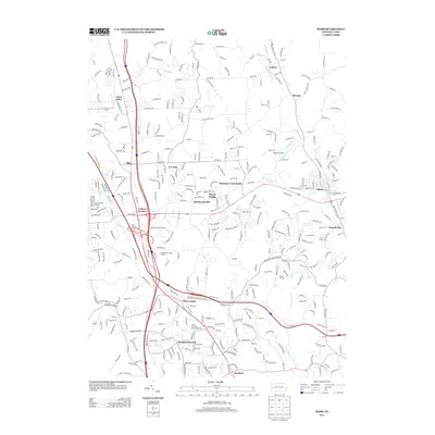
2013 Map of Mars
USGS Topo · Published 2013About this map
Seven Fields and the surrounding residential developments of southern Butler County define this landscape during a period of significant suburban expansion. The map detail highlights the convergence of several major transit corridors, including the I-79 and Us HWY 19 interchange at Criders Corners, which facilitated the growth of nearby Warrendale and Bradford Woods. This infrastructure supports a mix of established boroughs like Mars and Callery alongside modern recreational and community landmarks such as the Venango Trail Golf Course, Lakehill Airport, and the Hope Grange hall. The drainage patterns of Brush Cr and Kaufman Run weave through these developed areas, marking the transitional terrain between the northern Allegheny County border and the interior of the county. Smaller communities like Thielman Crossroads and Hendersonville remain visible, reflecting the area's older rural character before the turn-of-the-century suburban surge.
Find a feature on this map
32 named features on this map. Tap any name to fly to it.
Don’t see what you’re looking for? This feature index may not catch every label — zoom into the map to look around manually.
Map Details
Editions of this 2013 Mars Map
This is the sole edition of this map. No revisions or reprints were ever made.
Other maps of this area

1906 · Sewickley
USGS Topo · 1:62,500

1908 · Sewickley
USGS Topo · 1:62,500

1908 · New Kensington
USGS Topo · 1:62,500

1908 · Zelienople
USGS Topo · 1:62,500

1909 · Butler
USGS Topo · 1:62,500

1910 · New Kensington
USGS Topo · 1:62,500

1910 · Zelienople
USGS Topo · 1:62,500

1911 · Butler
USGS Topo · 1:62,500

1950 · Valencia
USGS Topo · 1:24,000

1951 · Canton
USGS Topo · 1:250,000