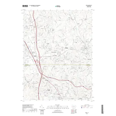
2019 Map of Mars
USGS Topo · Published 2019About this map
Seven Fields and Mars anchor this landscape along the Butler and Allegheny county line, where the suburban expansion of the northern Pittsburgh corridor meets established rural settlements. The map reveals a high concentration of spiritual and commemorative sites, from the Old Union Presbyterian Church Cemetery in the north to the Salem United Methodist Church Cemetery near Wexford. The transportation network is dominated by the convergence of I-79, US Route 19, and I-76, illustrating the rapid development surrounding Warrendale and Criders Corners.
Find a feature on this map
49 named features on this map. Tap any name to fly to it.
Don’t see what you’re looking for? This feature index may not catch every label — zoom into the map to look around manually.
Map Details
Editions of this 2019 Mars Map
This is the sole edition of this map. No revisions or reprints were ever made.
Other maps of this area

1906 · Sewickley
USGS Topo · 1:62,500

1908 · Sewickley
USGS Topo · 1:62,500

1908 · New Kensington
USGS Topo · 1:62,500

1908 · Zelienople
USGS Topo · 1:62,500

1909 · Butler
USGS Topo · 1:62,500

1910 · New Kensington
USGS Topo · 1:62,500

1910 · Zelienople
USGS Topo · 1:62,500

1911 · Butler
USGS Topo · 1:62,500

1950 · Valencia
USGS Topo · 1:24,000

1951 · Canton
USGS Topo · 1:250,000