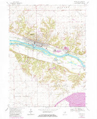
1970 Map of Marseilles
USGS Topo · Published 1984About this map
Marseilles centers this landscape at a significant juncture of the Illinois River, where industrial infrastructure meets the historic Illinois and Michigan Canal. The river is defined by heavy hydraulic engineering including the Marseilles Dam and a nearby Gaging Sta, while the northern banks host a Chemical Plant and substantial Waste Disposal Area. Away from the industrial corridor, the terrain transitions into the townships of Rutland, Miller, and Manlius, where family history is preserved in numerous burial grounds like Old Brumbach Cem, Stebbins Cem, and Shaver Cem. Small aviation sites such as the Mitchell Landing Strip and islands like Bells Island dot the map, showing a 1970s rural economy still tied closely to the river's path and the Chicago Rock Island and Pacific rail line.
Find a feature on this map
45 named features on this map. Tap any name to fly to it.
Don’t see what you’re looking for? This feature index may not catch every label — zoom into the map to look around manually.
Map Details
Editions of this 1970 Marseilles Map
3 editions found
Other maps of this area

1892 · Marseilles
USGS Topo · 1:62,500

1892 · Ottawa
USGS Topo · 1:62,500

1915 · Ottawa
USGS Topo · 1:62,500

1916 · Marseilles
USGS Topo · 1:62,500

1925 · Streator
USGS Topo · 1:62,500

1927 · Streator
USGS Topo · 1:62,500

1940 · Marseilles
USGS Topo · 1:62,500

1946 · Ottawa
USGS Topo · 1:62,500

1958 · Odell
USGS Topo · 1:62,500

1958 · Aurora
USGS Topo · 1:250,000