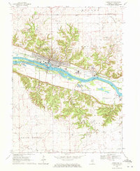
1970 Map of Marseilles
USGS Topo · Published 1972About this map
Marseilles serves as the industrial and transport hub of this Illinois River valley map, situated at the confluence of heavy rail, river navigation, and early canal infrastructure. The Illinois and Michigan Canal remains a prominent linear landmark, running parallel to the Chicago Rock Island and Pacific railroad and the Illinois River. This corridor supported a diverse economic base, evidenced by the chemical plant and various waste disposal areas near Johnson Island.
Find a feature on this map
44 named features on this map. Tap any name to fly to it.
Don’t see what you’re looking for? This feature index may not catch every label — zoom into the map to look around manually.
Map Details
Editions of this 1970 Marseilles Map
3 editions found
Other maps of this area

1892 · Marseilles
USGS Topo · 1:62,500

1892 · Ottawa
USGS Topo · 1:62,500

1915 · Ottawa
USGS Topo · 1:62,500

1916 · Marseilles
USGS Topo · 1:62,500

1925 · Streator
USGS Topo · 1:62,500

1927 · Streator
USGS Topo · 1:62,500

1940 · Marseilles
USGS Topo · 1:62,500

1946 · Ottawa
USGS Topo · 1:62,500

1958 · Odell
USGS Topo · 1:62,500

1958 · Aurora
USGS Topo · 1:250,000