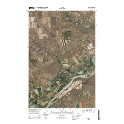
2014 Map of Marsh
USGS Topo · Published 2014About this map
The Yellowstone River anchors the southern portion of this landscape, carving a wide path through the eastern Montana terrain of Dawson County. The small settlement of Marsh sits just north of the river, serving as a focal point for local history and genealogy with several distinct burial grounds clustered nearby. Researchers will find the Missouri Lutheran Cem, Jehovah Lutheran Cem, and Marsh Cem all situated within close proximity to the township, suggesting a strong Lutheran heritage in this rural community.
Find a feature on this map
21 named features on this map. Tap any name to fly to it.
Don’t see what you’re looking for? This feature index may not catch every label — zoom into the map to look around manually.
Map Details
Editions of this 2014 Marsh Map
This is the sole edition of this map. No revisions or reprints were ever made.
Other maps of this area

1909 · Glendive
USGS Topo · 1:250,000

1953 · Miles City
USGS Topo · 1:250,000

1954 · Glendive
USGS Topo · 1:250,000

1957 · Miles City
USGS Topo · 1:250,000

1957 · Glendive
USGS Topo · 1:250,000

1958 · Miles City
USGS Topo · 1:250,000

1958 · Glendive
USGS Topo · 1:250,000

1966 · Fallon
USGS Topo · 1:24,000

1966 · Marsh SW
USGS Topo · 1:24,000

1967 · Marsh
USGS Topo · 1:24,000