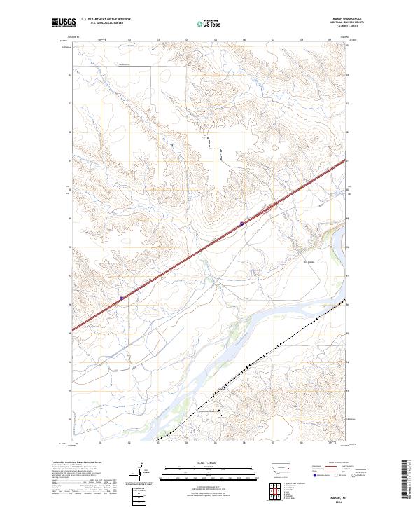
2024 Map of Marsh
USGS Topo · Published 2024About this map
The Yellowstone River cuts a wide, braided path through the center of this Dawson County landscape, anchoring the small settlement of Marsh. This river valley community is defined by its deep cultural roots, evident at the Gluecksthal Lutheran Ch and the nearby Marsh Cem, which serve as vital landmarks for genealogists tracing the history of local homesteading families. The surrounding terrain is marked by a network of drainage systems, including Cracker Box Creek and its North Fork, along with the distinct Dry Coulee to the east. Transportation through this expansive area is facilitated by RD 260 and various rural routes like Whoopup RD, which navigate the high ground above the river's floodplain. The map captures a moment of transition between the fertile river bottomlands and the dissected uplands of eastern Montana.
Find a feature on this map
23 named features on this map. Tap any name to fly to it.
Don’t see what you’re looking for? This feature index may not catch every label — zoom into the map to look around manually.
Map Details
Editions of this 2024 Marsh Map
This is the sole edition of this map. No revisions or reprints were ever made.
Other maps of this area

1909 · Glendive
USGS Topo · 1:250,000

1953 · Miles City
USGS Topo · 1:250,000

1954 · Glendive
USGS Topo · 1:250,000

1957 · Miles City
USGS Topo · 1:250,000

1957 · Glendive
USGS Topo · 1:250,000

1958 · Miles City
USGS Topo · 1:250,000

1958 · Glendive
USGS Topo · 1:250,000

1966 · Fallon
USGS Topo · 1:24,000

1966 · Marsh SW
USGS Topo · 1:24,000

1967 · Marsh
USGS Topo · 1:24,000