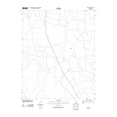
2010 Map of Marsh
USGS Topo · Published 2010About this map
Marsh is the central point of interest in this high-plains landscape of Potter County, situated where a straight thoroughfare cuts diagonally through the sectioned terrain. The topography is defined by the headwaters and drainage of several watercourses, including the westward flow of Corral Creek and the meandering paths of Lahey Creek and Little Lahey Creek. To the east, the terrain breaks into more complex relief near John Ray Butte and the significant depression of Big Canyon. The presence of Gravel Pit Rd suggests localized extraction activity in a region otherwise dominated by large-scale ranching and open land. This 2010 survey illustrates the modern configuration of the Texas Panhandle, where the historical names of creeks like John Ray Creek, McDowell Creek, and Ranch Creek persist alongside contemporary road networks.
Find a feature on this map
10 named features on this map. Tap any name to fly to it.
Don’t see what you’re looking for? This feature index may not catch every label — zoom into the map to look around manually.
Map Details
Editions of this 2010 Marsh Map
This is the sole edition of this map. No revisions or reprints were ever made.
Other maps of this area

1934 · Ady
USGS Topo · 1:62,500

1934 · Cliffside
USGS Topo · 1:62,500

1936 · Fourways
USGS Topo · 1:62,500

1936 · Cliffside
USGS Topo · 1:62,500

1936 · Ady
USGS Topo · 1:62,500

1953 · Chunky
USGS Topo · 1:24,000

1953 · Marsh
USGS Topo · 1:24,000

1953 · Puente
USGS Topo · 1:24,000

1953 · Masterson
USGS Topo · 1:24,000

1953 · McDowell Creek
USGS Topo · 1:24,000