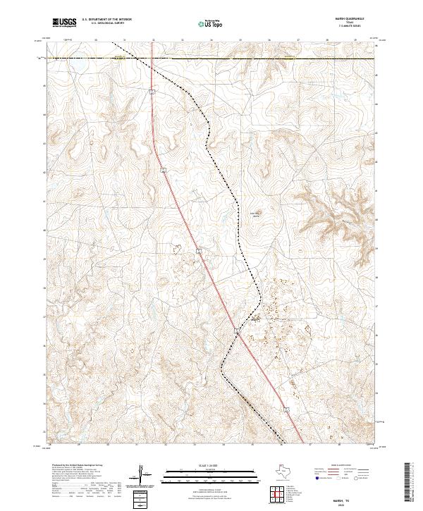
2022 Map of Marsh
USGS Topo · Published 2022About this map
Marsh sits within a landscape defined by the drainage basins of the Texas Panhandle, just south of the Moore Co Potter Co line. The topography here is deeply etched by water, with Lahey Cr and Little Lahey Creek carving winding paths through the terrain. These drainages, alongside John Ray Creek and McDowell Cr, create a complex network of draws and breaks typical of the Canadian River valley region. Distinctive geological markers like John Ray Butte and the expansive Big Canyon provide clear reference points for the local geography.
Find a feature on this map
14 named features on this map. Tap any name to fly to it.
Don’t see what you’re looking for? This feature index may not catch every label — zoom into the map to look around manually.
Map Details
Editions of this 2022 Marsh Map
This is the sole edition of this map. No revisions or reprints were ever made.
Other maps of this area

1934 · Ady
USGS Topo · 1:62,500

1934 · Cliffside
USGS Topo · 1:62,500

1936 · Fourways
USGS Topo · 1:62,500

1936 · Cliffside
USGS Topo · 1:62,500

1936 · Ady
USGS Topo · 1:62,500

1953 · Chunky
USGS Topo · 1:24,000

1953 · Marsh
USGS Topo · 1:24,000

1953 · Puente
USGS Topo · 1:24,000

1953 · Masterson
USGS Topo · 1:24,000

1953 · McDowell Creek
USGS Topo · 1:24,000