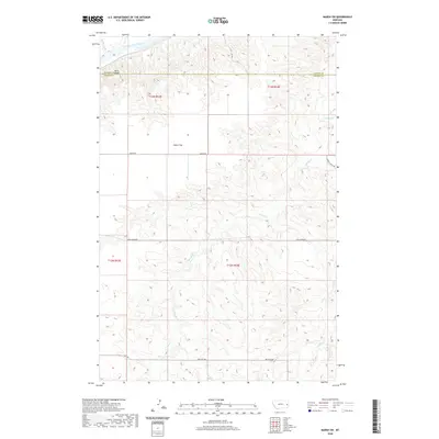
2020 Map of Marsh SW
USGS Topo · Published 2020About this map
The Yellowstone River flows along the northern boundary of this Prairie County terrain, where the high ground of Barrs Bluffs overlooks the river valley. The landscape is defined by its drainage network, with several seasonal waterways including Bad Route Cr, Spring Cr, and Ash Cr carving through the plains. This area sits along the border of Dawson County and Prairie County, showing the intersection of several significant local transit corridors like Marsh Rd and Cabin Creek Rd. Large, open geographic areas like Fallon Flat suggest the expansive, agricultural nature of this part of eastern Montana. The map also records the precise township and range boundaries, such as t13n r53e and t12n r54e, which are essential for property researchers and genealogists tracing specific land patents in this sparsely settled region.
Find a feature on this map
18 named features on this map. Tap any name to fly to it.
Don’t see what you’re looking for? This feature index may not catch every label — zoom into the map to look around manually.
Map Details
Editions of this 2020 Marsh SW Map
This is the sole edition of this map. No revisions or reprints were ever made.
Other maps of this area

1953 · Miles City
USGS Topo · 1:250,000

1957 · Miles City
USGS Topo · 1:250,000

1958 · Miles City
USGS Topo · 1:250,000

1966 · Fallon
USGS Topo · 1:24,000

1966 · Marsh SW
USGS Topo · 1:24,000

1967 · Marsh
USGS Topo · 1:24,000

1967 · Hoyt
USGS Topo · 1:24,000
1967 · Fallon NE
USGS Topo · 1:24,000

1969 · Flat Top Butte NE
USGS Topo · 1:24,000

1980 · Terry
USGS Topo · 1:100,000