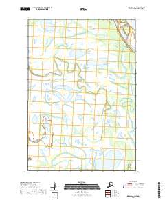
2018 Map of Marshall C-1 NE
USGS Topo · Published 2018About this map
The Kusilvak Census Area landscape is defined by an intricate network of waterways and wetlands, as mapped by the U.S. Geological Survey in 2018. The terrain is structured by the Public Land Survey System, specifically within T19n R71w, T19n R70w, T18n R71w, and T18n R70w. This specific quadrangle covers a region where the hydrological data from the National Hydrography Dataset reveals a complex pattern of small lakes and ponds typical of the Alaskan tundra. While no formal settlements or names were provided in the GNIS data at the time of this survey, the map provides a precise layout of the township and range lines that govern land division in this remote stretch of the state.
Find a feature on this map
4 named features on this map. Tap any name to fly to it.
Don’t see what you’re looking for? This feature index may not catch every label — zoom into the map to look around manually.
Map Details
Editions of this 2018 Marshall C-1 NE Map
This is the sole edition of this map. No revisions or reprints were ever made.
Other maps of this area

1947 · Russian Mission
USGS Topo · 1:250,000

1950 · Russian Mission
USGS Topo · 1:250,000

1951 · Marshall
USGS Topo · 1:250,000

1952 · Russian Mission C-8
USGS Topo · 1:63,360
1952 · Russian Mission D-8
USGS Topo · 1:63,360

1952 · Marshall C-1
USGS Topo · 1:63,360
1952 · Marshall D-1
USGS Topo · 1:63,360

1954 · Marshall
USGS Topo · 1:250,000

1980 · Russian Mission
USGS Topo · 1:250,000
2017 · Russian Mission C-8 NW
USGS Topo · 1:25,000