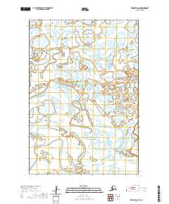
2020 Map of Marshall D-6 NE
USGS Topo · Published 2020About this map
Kipungolak River meanders across this low-lying landscape, defining the intricate hydrological character of the area within the t22n r80w and t21n r80w townships. The terrain is marked by a dense network of sloughs, ponds, and marshlands, illustrating the dynamic nature of the delta environment where water and land are in constant transition. Along the eastern edge, the Nantok River flows through the wetland complex, highlighting the remote and undeveloped state of the region in the early 21st century. This map documents a wilderness landscape shaped almost entirely by natural watercourses, lacking the roads or permanent settlements found in more developed coastal regions of Alaska.
Find a feature on this map
6 named features on this map. Tap any name to fly to it.
Don’t see what you’re looking for? This feature index may not catch every label — zoom into the map to look around manually.
Map Details
Editions of this 2020 Marshall D-6 NE Map
This is the sole edition of this map. No revisions or reprints were ever made.
Other maps of this area

1951 · Marshall
USGS Topo · 1:250,000

1952 · Kwiguk
USGS Topo · 1:250,000

1952 · Kwiguk A-5
USGS Topo · 1:63,360

1952 · Kwiguk A-4
USGS Topo · 1:63,360

1952 · Marshall D-5
USGS Topo · 1:63,360

1952 · Marshall D-6
USGS Topo · 1:63,360

1954 · Marshall
USGS Topo · 1:250,000
2020 · Marshall D-6 SW
USGS Topo · 1:25,000
2020 · Marshall D-5 SW
USGS Topo · 1:25,000
2020 · Marshall D-6 NW
USGS Topo · 1:25,000