
1952 Map of Kwiguk A-5
USGS Topo · Published 1959About this map
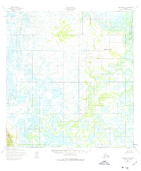
The Yukon River delta is captured here in a complex network of waterways, where the river's immense volume breaks into intricate distributaries like the Tununorak Channel. This mid-century survey illustrates a dynamic landscape of wetlands and tidal influences, dominated by the winding path of the Igrikuk Slough. While much of the terrain is low-lying marsh, prominent relief is provided by landmarks such as Ingrichuak Hill and various survey stations used by the Army Map Service. The presence of VABM Army 389 and VABM Scarp 98 indicates the strategic importance of these high points for geodetic control in an otherwise fluid and shifting environment. This map serves as a detailed record of the delta's hydraulic patterns before contemporary changes, documenting the natural state of these remote Alaskan channels and hills.
Find a feature on this map
7 named features on this map. Tap any name to fly to it.
Don’t see what you’re looking for? This feature index may not catch every label — zoom into the map to look around manually.
Map Details
Editions of this 1952 Kwiguk A-5 Map
2 editions found
Other maps of this area

1951 · Marshall
USGS Topo · 1:250,000

1952 · Kwiguk
USGS Topo · 1:250,000

1952 · Kwiguk B-6
USGS Topo · 1:63,360

1952 · Kwiguk A-6
USGS Topo · 1:63,360

1952 · Kwiguk B-5
USGS Topo · 1:63,360

1952 · Kwiguk A-4
USGS Topo · 1:63,360

1952 · Kwiguk B-4
USGS Topo · 1:63,360
1952 · Marshall D-7
USGS Topo · 1:63,360

1952 · Marshall D-6
USGS Topo · 1:63,360

1954 · Marshall
USGS Topo · 1:250,000