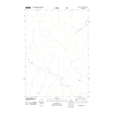
2011 Map of Marshall Peak
USGS Topo · Published 2011About this map
Silver King Mine sits in the northeastern corner of this drainage basin, representing the area's legacy of mountain mineral extraction. The landscape is defined by the headwaters of the South Fork Boise River and its complex network of tributaries, including Johnson Creek and Gold Run Creek. High-elevation landmarks like Marshall Peak overlook the Ross Fork Basin, while Perkins Lake and Perkins Creek provide focal points for the high-country hydrology. The presence of Beaver Creek Rd following the course of Beaver Creek indicates the limited but essential transportation corridors through this part of Elmore County. This map shows a terrain dominated by natural drainage patterns and the isolated remains of industrial prospecting.
Find a feature on this map
19 named features on this map. Tap any name to fly to it.
Don’t see what you’re looking for? This feature index may not catch every label — zoom into the map to look around manually.
Map Details
Editions of this 2011 Marshall Peak Map
This is the sole edition of this map. No revisions or reprints were ever made.
Other maps of this area

1894 · Rocky Bar
USGS Topo · 1:125,000

1900 · Sawtooth
USGS Topo · 1:125,000

1955 · Hailey
USGS Topo · 1:250,000

1959 · Hailey
USGS Topo · 1:250,000

1962 · Hailey
USGS Topo · 1:250,000

1963 · Alturas Lake
USGS Topo · 1:24,000

1964 · Frenchman Creek
USGS Topo · 1:24,000

1964 · Ross Peak
USGS Topo · 1:24,000
1964 · Snowyside Peak
USGS Topo · 1:24,000

1964 · Marshall Peak
USGS Topo · 1:24,000