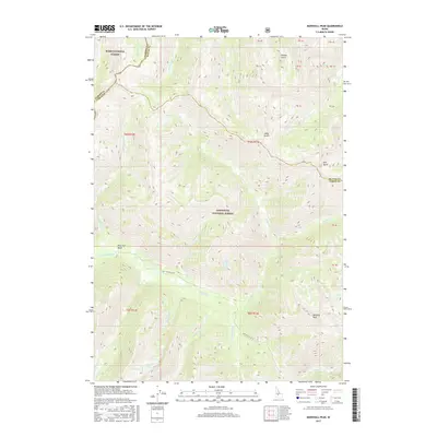
2017 Map of Marshall Peak
USGS Topo · Published 2017About this map
Marshall Peak dominates the high-elevation landscape of central Idaho, where the borders of Elmore and Blaine Counties meet. This 2017 survey details a wilderness environment defined by the headwaters of major drainage systems, notably the S Fork Boise River and the complex network of the Ross Fork and its tributaries. The terrain is divided between the Sawtooth National Forest and the Boise National Forest, with deep drainage features like Eureka Gulch and Jakes Gulch carving into the mountainous ridges.
Find a feature on this map
32 named features on this map. Tap any name to fly to it.
Don’t see what you’re looking for? This feature index may not catch every label — zoom into the map to look around manually.
Map Details
Editions of this 2017 Marshall Peak Map
This is the sole edition of this map. No revisions or reprints were ever made.
Other maps of this area

1894 · Rocky Bar
USGS Topo · 1:125,000

1900 · Sawtooth
USGS Topo · 1:125,000

1955 · Hailey
USGS Topo · 1:250,000

1959 · Hailey
USGS Topo · 1:250,000

1962 · Hailey
USGS Topo · 1:250,000

1963 · Alturas Lake
USGS Topo · 1:24,000

1964 · Frenchman Creek
USGS Topo · 1:24,000

1964 · Ross Peak
USGS Topo · 1:24,000
1964 · Snowyside Peak
USGS Topo · 1:24,000

1964 · Marshall Peak
USGS Topo · 1:24,000