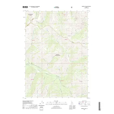
2020 Map of Marshall Peak
USGS Topo · Published 2020About this map
Marshall Peak stands as the central topographic focal point in this high-elevation region where the borders of Elmore, Blaine, and Camas counties converge. The landscape is defined by the headwaters of several significant drainages, including the S Fork Boise River and Johnson Creek. This modern survey documents the rugged intersection of the Boise National Forest and the Sawtooth National Forest, showing a territory primarily navigated by primitive routes like the Johnson Creek Jeep Trail and the Ross Fork Horse Trail. Pockets of water such as Perkins Lake and Alturas Lake-Mattingly are tucked into high glacial basins, while numerous gulches like Eureka Gulch and Mill Gulch suggest a history of resource exploration. The absence of paved infrastructure highlights the preservation of this alpine environment in the early 21st century.
Find a feature on this map
43 named features on this map. Tap any name to fly to it.
Don’t see what you’re looking for? This feature index may not catch every label — zoom into the map to look around manually.
Map Details
Editions of this 2020 Marshall Peak Map
This is the sole edition of this map. No revisions or reprints were ever made.
Other maps of this area

1894 · Rocky Bar
USGS Topo · 1:125,000

1900 · Sawtooth
USGS Topo · 1:125,000

1955 · Hailey
USGS Topo · 1:250,000

1959 · Hailey
USGS Topo · 1:250,000

1962 · Hailey
USGS Topo · 1:250,000

1963 · Alturas Lake
USGS Topo · 1:24,000

1964 · Frenchman Creek
USGS Topo · 1:24,000

1964 · Ross Peak
USGS Topo · 1:24,000
1964 · Snowyside Peak
USGS Topo · 1:24,000

1964 · Marshall Peak
USGS Topo · 1:24,000