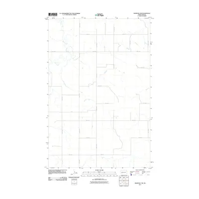
2011 Map of Marshall SW
USGS Topo · Published 2011About this map
Deep Creek meanders through this portion of Stark County, defining the drainage patterns of an otherwise orderly agricultural landscape. The map reveals the rigid section-line organization of western North Dakota, where a geometric grid of gravel and section roads like 93rd Ave SW and 22nd St SW provide the primary framework for local travel. This systematic layout is typical of the Great Plains' settlement history, ensuring accessibility for the isolated farmsteads that dot the prairie. While primarily rural, the subtle elevation changes and the winding course of the creek create distinct deviations from the straight-line routes of 91st Ave SW and 25th St SW. The area's character is one of vast, productive open space, shaped by both the natural path of the water and the deliberate engineering of the county road system.
Find a feature on this map
15 named features on this map. Tap any name to fly to it.
Don’t see what you’re looking for? This feature index may not catch every label — zoom into the map to look around manually.
Map Details
Editions of this 2011 Marshall SW Map
This is the sole edition of this map. No revisions or reprints were ever made.
Other maps of this area

1953 · Dickinson
USGS Topo · 1:250,000

1953 · Watford City
USGS Topo · 1:250,000

1957 · Dickinson
USGS Topo · 1:250,000

1957 · Watford City
USGS Topo · 1:250,000

1967 · Watford City
USGS Topo · 1:250,000

1973 · Marshall SE
USGS Topo · 1:24,000

1973 · Boyle
USGS Topo · 1:24,000

1973 · Taylor
USGS Topo · 1:24,000

1973 · Marshall SW
USGS Topo · 1:24,000

1973 · Ziner Butte
USGS Topo · 1:24,000