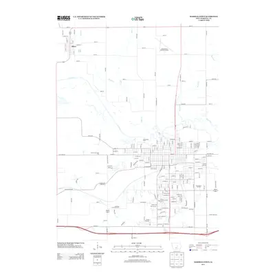
2013 Map of Marshalltown
USGS Topo · Published 2013About this map
The Iowa River meanders across this Central Iowa landscape, defining the northern approaches to Marshalltown and the smaller settlement of Albion to the northwest. This modern survey illustrates the region's complex water network, where numerous tributaries including Chicken Creek, Asher Creek, and Burnett Creek converge toward the main river valley. The layout of the city is anchored by the historic Iowa Soldiers Home and the commercial corridor along W Lincoln Way, while the southern reaches are marked by the Marshalltown Speedway and recreation areas like the Wandering Creek Golf Course.
Find a feature on this map
93 named features on this map. Tap any name to fly to it.
Don’t see what you’re looking for? This feature index may not catch every label — zoom into the map to look around manually.
Map Details
Editions of this 2013 Marshalltown Map
This is the sole edition of this map. No revisions or reprints were ever made.
Other maps of this area

1954 · Waterloo
USGS Topo · 1:250,000

1954 · Des Moines
USGS Topo · 1:250,000

1955 · Waterloo
USGS Topo · 1:250,000

1956 · Des Moines
USGS Topo · 1:250,000

1957 · Des Moines
USGS Topo · 1:250,000

1960 · Marshalltown
USGS Topo · 1:24,000

1960 · Marshalltown
USGS Topo · 1:62,500

1960 · Le Grand
USGS Topo · 1:24,000

1960 · Conrad West
USGS Topo · 1:24,000

1960 · Conrad East
USGS Topo · 1:24,000