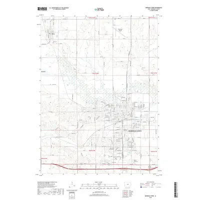
2018 Map of Marshalltown
USGS Topo · Published 2018About this map
Marshalltown serves as the central hub of this 2018 survey, where the urban grid is bisected by the winding paths of Linn Creek and Anson Cr. The city’s northern edge is defined by the Iowa River, which separates the metropolitan center from the rural townships of t85n r18w and t85n r17w. Several significant burial grounds, including Riverside Cem near the riverbanks and the expansive Rose Hill Memorial Gardens Cem to the south, offer valuable points of reference for local family historians. Outside the city core, the smaller settlements of Albion and Marietta anchor the northwestern territory, surrounded by the drainages of Asher Cr and Chicken Cr. This landscape illustrates the transition between a developed industrial and residential center and the systematically partitioned Iowa farmland that sustains it.
Find a feature on this map
93 named features on this map. Tap any name to fly to it.
Don’t see what you’re looking for? This feature index may not catch every label — zoom into the map to look around manually.
Map Details
Editions of this 2018 Marshalltown Map
This is the sole edition of this map. No revisions or reprints were ever made.
Other maps of this area

1954 · Waterloo
USGS Topo · 1:250,000

1954 · Des Moines
USGS Topo · 1:250,000

1955 · Waterloo
USGS Topo · 1:250,000

1956 · Des Moines
USGS Topo · 1:250,000

1957 · Des Moines
USGS Topo · 1:250,000

1960 · Marshalltown
USGS Topo · 1:24,000

1960 · Marshalltown
USGS Topo · 1:62,500

1960 · Le Grand
USGS Topo · 1:24,000

1960 · Conrad West
USGS Topo · 1:24,000

1960 · Conrad East
USGS Topo · 1:24,000