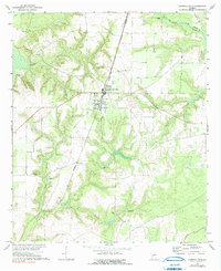
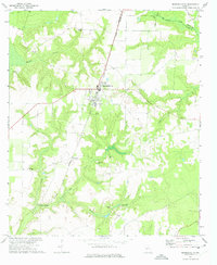
1972 Map of Marshallville
USGS Topo · Published 1991About this map
Marshallville serves as the central hub of this Georgia landscape, situated along the line of the Central of Georgia railroad. The map illustrates a transition between the organized street grid of the town and the surrounding agricultural lands marked by numerous small branches and creeks. To the northwest, an Indian Burial Mound stands near Bryants Swamp, indicating a deep history of human presence on the land long before the establishment of modern settlements like Winchester or Lowes Crossing.
Find a feature on this map
24 named features on this map. Tap any name to fly to it.
Don’t see what you’re looking for? This feature index may not catch every label — zoom into the map to look around manually.
Map Details
Editions of this 1972 Marshallville Map
2 editions found
Other maps of this area

1955 · Phenix City
USGS Topo · 1:250,000

1956 · Fort Valley
USGS Topo · 1:62,500

1957 · Phenix City
USGS Topo · 1:250,000

1957 · Macon
USGS Topo · 1:250,000

1958 · Macon
USGS Topo · 1:250,000

1958 · Phenix City
USGS Topo · 1:250,000

1964 · Macon
USGS Topo · 1:250,000

1971 · Reynolds
USGS Topo · 1:24,000

1971 · Garden Valley
USGS Topo · 1:24,000

1971 · Montezuma
USGS Topo · 1:24,000